Visual Analytics to Explore Iceberg Movement
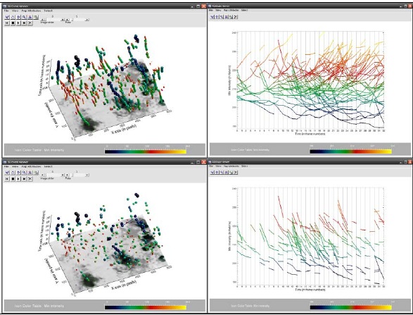
Remote sensing image repositories are the fastest growing archives of spatio-temporal information. This leads to large time-series that geoscientists need to explore and understand. Effective exploratory tools are urgently needed to handle the large data sets efficiently. Common application areas that require such tools are, amongst others: climate change and environmental monitoring studies, hazard analysis, and the management of agriculture, forest and water resources.
Large time-series of remote sensing data are often explored by animating image sequences with user controlled interactions (play, stop, change display speed etc.). However, evidences from evaluation studies show a rather mixed trend – despite being interactive, animated time series still lead to information overload, often limiting their exploratory usage. […]
Read the full article here:
Visual Analytics to Explore Iceberg Movement
Ulanbek Turdukulov, Connie Blok
ITC – International Institute for Geo-Information Science and Earth Observation,
PO Box 6, 7500 AA, Enschede, the Netherlands
0 Comments
You can be the first one to leave a comment.